MSDI Data: Elevation
 This committee has been replaced by the
Elevation
Committee and its
LiDAR Research
and Education Subcommittee of the Minnesota Geospatial Advisory
Council. See their webpages for more recent information.
This committee has been replaced by the
Elevation
Committee and its
LiDAR Research
and Education Subcommittee of the Minnesota Geospatial Advisory
Council. See their webpages for more recent information.
Elevation refers to a spatially referenced vertical position above or below a reference datum surface for the earth. Elevations are most often represented on maps as contour lines, but are more usefully created as Digital Elevation Models (DEM) or Digital Terrain Models (DTM). A DEM contains elevation or height values (z) at regularly spaced intervals in the x and y directions. A DTM represents elevations (z) at irregularly or randomly spaced (x,y) intervals or as a DEM that has been augmented discontinuities known as break lines.
The strategic plan for addressing the state's needs for elevation data was developed by an elevation data workgroup with assistance from the Strategic Plan Committee of the Governor's Council on Geographic Information.
DATA USES
Elevation data are used for engineering studies, flood hazard mitigation and prevention, watershed management, transportation planning, mapping and site design, and soil analysis. Elevation data is often combined with other digital data for modeling and mapping applications, such as regional hydrologic modeling studies. Elevation also is used as input to create orthoimagery, watershed, floodplain, flow modeling data, and elevation contour lines.
DATA STATUS
The only elevation data product available statewide for Minnesota is produced by the U.S. Geological Survey (USGS) as a DEM using 10 or 30 meter grid spacing for 7.5 by 7.5 minute blocks corresponding to 1:24,000 quadrangle maps that are widely used by hikers and campers. Many uses of elevation data can be supported by medium-resolution data available for the entire state, but some applications require higher resolution sources that will require additional investments.
Statewide 30-Meter DEM. When the U.S. Geological Survey produced digital orthophoto quads for Minnesota in the late 1980s and early 1990s, it also produced DEMs using a 30 meter grid from contours published on its 1:24,000 topographic maps. Benefiting from technology changes since this USGS program, DEMs for Minnesota have now been completed using newer “level 2” technology. This data is being augmented by the Minnesota Department of Natural Resources, which is working to improve watershed delineations by producing ‘hydrologically-corrected’ DEMs incorporating DNR stream data.
Higher-resolution data. Existing statewide data is not precise enough for some needs, although it often is the best available source. For example, half of the flood plain maps for Minnesota show no elevations and those that do show imprecise elevations derived from USGS quadrangle maps. Several initiatives are underway to improve elevation data available for Minnesota, including a committee working with the DNR to seek funding for a partnership with the Federal Emergency Management Agency (FEMA) to produce 2-foot contour maps statewide. A recent white paper outlines the need, benefits and the funding needed to produce this result.
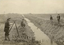
A U.S. Army Corps of Engineers study of the Red River Basin recommends development of a seamless 10-meter DEM for the entire Red River Basin, with higher-resolution data for the 1997 flood boundary. Some high accuracy maps have been created for the Red River Basin using Light Detection and Ranging (LIDAR) technology. The Fargo-Moorhead, Wahpeton, and Lower Wild Rice River areas have been completed and other pilot projects are planned. Some local and state agencies have created more precise elevation data for specific projects.
PLAN STATUS
A draft MSDI Elevation data plan was prepared and presented to the Data Committee in January 2003.
COSTS AND FINANCING
The high-resolution elevation white paper estimated that $41 million would be needed to produce a DEM or DTM for the nearly 84,000 square miles of Minnesota, not including data management costs. A concerted effort is being made to combine state funds with federal funding through FEMA to finance this effort. A proposal has been presented to the State Legislature.
KEY ISSUES
- Obtain funding for more accurate mapping thereby, as an example, save millions annually by utilizing data collected to mitigate and prevent flooding.
- Focus on commonly needed data for collaborative data exchange statewide.
- Collect and make available information on the active and planned projects in Minnesota.
- Create standards identifying best practices and conventions to insure interoperability of data collected among primary data providers.
- Take advantage of any opportunity to leverage funding that will assist in completing a more accurate statewide DEM that will support a myriad of uses.
RESOURCES
- Elevation Data I-Plan, Version 2.2 (August, 2003). Plan prepared by the MSDI Elevation data workgroup.