GLO Historic Plat Map
Retrieval System
This site is best viewed on a monitor with a resolution setting of 1024 x 768. It uses code supported by Netscape 4.7 or up and Internet Explorer 5 or up.
Problems and Inaccuracies |
||
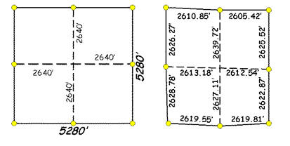
| The science of measurement is not absolute and therefore the original surveyors were allowed to perform their work within a certain tolerance. Errors in measurement, and because meridians converge as they run north, make townships vary in size and shape from a perfect township. | ||
The Intention |
The Reality |
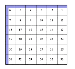
Tolerance was built into the surveying process. All surplus or deficiency was allocated to the sections along the north and west boundaries of townships. For this reason, few of these sections measure exactly 640 acres in size. |
 |
||
|
|
Because of errors or malfunction of
equipment, some lines did not fall within tolerance. A system
of checks and balances aimed to minimize such error, with the
Surveyor General’s Office having the power to withdraw
contracts from deputy surveyors whose work showed
incompetence. The Surveyor General could then order the plat
corrected or the area resurveyed.
|
|