 |
 |
 |
|
Program Agenda |
June 24, 2004 The purpose of this workshop was to help GIS users who may not be using remote sensing data resources to better understand the technology and to learn about current data resources and how they might be used in GIS. Follow links to
view presentation materials. | ||||||||||||
Morning
|
||||||||||||||
9:00 – 9:15am |
Introduction Chris Cialek – welcome, logistics Matt Mercurio – sponsor's message Jim Hipple – scope, schedule overview & intro first speaker |
|||||||||||||
|
||||||||||||||
| 9:15 – 10:30pm |
(Click here to link to U of M Remote Sensing Laboratory website for materials) Speaker: Dr. Marv Bauer; Department of Forest Resources |
|||||||||||||
| 10:45 – 11:45am |
Speakers: Brian Huberty; U.S. Fish & Wildlife Service, and
|
|||||||||||||
|
Afternoon
|
Session 1 | Acquisition and Applications of LIDAR for GIS (View PowerPoint 44MB) | ||||||||||||
1:00 –
3:45pm |
Speaker: Mike Renslow; Vice-President, Spencer Gross, Inc. (*includes a 15 minute break) |
|||||||||||||
| Session 2 |
Imagery Applications in State & Local Governments |
|||||||||||||
| 1:00 – 2:00pm |
|
|||||||||||||
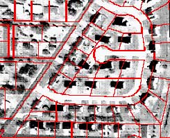
| 2:15 – 3:00pm | Orthoimagery & Aerial Photography Primer (View PowerPoint 11MB) Speaker: Bill Befort; Minnesota Department of Natural Resources |
|||||||||||||
| 3:00 – 3:45pm |
High Resolution Space Based Imagery (IKONOS, Digital Globe & OrbImage) ( View PDF 15MB) Speaker: Mark Johnson; St. Mary's University of Minnesota |
|||||||||||||

|
|