MSDI Data: Cadastral
This committee has been replaced by the Parcels and Land Records Committee of the Minnesota Geospatial Advisory Council. See their webpage for more recent information.
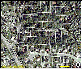
Commonly referred to as “parcel data,” cadastral data consist of the boundaries of land ownership parcels and attributes of those parcels. The spatial accuracy of parcel boundary data varies according to the needs of data producers, generally county governments, which also maintain a wide variety of attributes for each parcel to support their property taxation functions. These attributes generally include information about the property owner, taxpayer, structures located on the parcel, financial interests, and descriptors related to the value and use of land. Both components – boundaries and attributes - change rapidly as new property is created and existing property is reevaluated, improved, sold or redeveloped.
The Land Records Modernization Committee of the Governor's Council on Geographic Information served as the MSDI Cadastral data workgroup. Its members were responsible for developing and maintaining a strategic plan for meeting the state's needs for parcel data.
DATA USES
Parcel data rank among the top data needs of Minnesota governments and support a wide variety of day-to-day business functions. Aside from mapping ownership, uses include analyzing site locations, mapping results of program evaluations, contacting property owners, evaluating development proposals, estimating community growth potential, managing natural resources, and road management.
DATA STATUS
The goal of the Cadastral I-Plan is that all parcel data within Minnesota be maintained by primary producers, generally counties, in digital formats that can be assembled easily for multi-county and statewide applications. As of 2004, 57 of the state’s 87 counties reported they had developed some digital parcel boundaries, but 38 had not completed the task and only 37 could link their boundaries to tax roll databases. Data accuracies vary greatly among counties.
Although the principal producers of parcel data within Minnesota are its 87 counties, cities, state and federal governments, and tribal governments own considerable land. Collectively, federal agencies own and manage 3.4 million acres within Minnesota. With more than 5.6 million acres, the state is the third largest landowner in the nation. Completing a comprehensive statewide cadastral layer will require participation of all organizations owning land within Minnesota.
Few ongoing programs exist to assemble parcel data across county boundaries. An exception is a regional aggregation assembled for the seven metropolitan counties by MetroGIS. The MetroGIS project demonstrates the value of best management practices, technical standards, and organizational agreements when assembling a consistent parcel dataset from county sources. The MetroGIS regional parcel dataset retains the original accuracy and includes a subset of common attributes from the county sources. Statewide, the Department of Revenue annually collects parcel valuation data from counties and aggregates them to support its tax analysis and equalization functions, but the data does not include maps or parcel boundaries.
PLAN STATUS
Version 1.2 of the Cadastral I-Plan was completed in 2003.
COSTS AND FINANCING
Developing and maintaining accurate parcel data is expensive, costing Minnesota’s counties and cities an investment estimated at about $9 million. In addition, several state agencies and tribal governments maintain parcel data for their holdings. An additional $10 to $15 million will be required to complete parcel mapping for the entire state, with annual maintenance costs estimated at several million dollars to maintain current data.
Additional investments will be required to achieve interoperability of data produced by primary producers so that data can be integrated across county boundaries. The annual costs for technical integration can be minimized through adherence to best practices and technical standards, but based upon the experience of MetroGIS , the costs associated with local policies establishing agreements and implementing processes and procedures can be significant and must be revisited every few years.
KEY ISSUES
- Digital parcel mapping must be initiated and maintained in 31 counties that do not currently have programs of their own. Funding often is the critical constraint.
- Institutional relationships between the primary producers and those responsible for assembling parcel data for larger areas are critical but difficult to establish and nurture.
- Best practices, guidelines, and standards are needed to insure that digital parcel boundary data and attribute data produced by adjoining counties can be assembled for regions and, ultimately, for a statewide aggregation.
- Funding is inadequate, not only to support primary production of parcel boundary data but also to support data aggregation across jurisdictional boundaries.
- Licensing restrictions and cost recovery policies of data producers can inhibit joint data development, data availability, and data aggregation across jurisdictional boundaries.
RESOURCES
- Cadastral I-Plan, Version 1.2 (February, 2003). Plan adopted by MN Governor's Council on Geographic Information.
- Land Records Modernization Program, Executive Summary. Summarizes features and recommendations developed for a statewide program for Minnesota.
- Program Summary for Local Governments (1997). Brief explanation of benefits of standardized parcel mapping to Minnesota's local units of government.
- Land Records Modernization committee report (1999). Year-end report from the 1999 LRM committee. Appendices include the full LRM proposal, a hypothetical distribution of funds to counties based upon the proposal's allocation model, recommended data standards, and a glossary.
- Implementation Guide for Parcel-Based GIS in Minnesota Local Government (November 1997). This is a "blueprint" resource, to be used by local units of government, for successful implementation of parcel-based GIS in Minnesota
- Identifying Land Parcels: Is a Statewide Standard Needed? ( September 1997). Examines parcel identification numbers used by Minnesota's 87 counties and the need for a standardized statewide format.
- National Cadastral Standards. The Federal Geographic Data Committee's Cadastral Subcommittee coordinates the development and review of the FGDC cadastral standard. The site also contains links to adopted and proposed cadastral standards from a number of states.
- Wisconsin Cadastral Content Standard. This standard was adopted by the Wisconsin Land Information Association in 1999 to guide data development for the Wisconsin Land Records Modernization program.
- Wisconsin Grant Application Packet, 2004. Includes grant application instructions and contains data about funds generated for program.
- Wisconsin Land Information Board. The WLIB oversees the Wisconsin Land Records Modernization program. This site contains links to Wisconsin LRM resources, including county LRM plans, state GIS integration plans, program evaluations, grant information, and other technical resources.