Second Generation Lidar Elevation Data for Minnesota
Explore information and resources for understanding and accessing 2021-2024 (second generation) lidar data and derivatives for Minnesota.
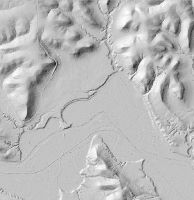
About the Second Generation Statewide Lidar Acquisition
- Minnesota Lidar Hub: Various resources related to the need, availability, and plans for Minnesota lidar data, with much focus on the second generation statewide lidar acquisition
- Minnesota Lidar Plan: Acquisition plan for the second generation lidar collection in Minnesota
- Minnesota Lidar Plan StoryMap: An introduction to lidar, how it is used in Minnesota, and the need for a second generation lidar acquisition.
Accessing the Data

The second generation of Minnesota's lidar data and derivatives may be accessed from various sources. See the MnTopo 2 and Second Generation Lidar Data Training session to learn more about the intended use of these access points and best practices for using the data. Additional resources such as user guides and short tutorials are also available below.
- MnTopo 2: A web application to interact with high-resolution elevation data for Minnesota collected using lidar technology
- User Guide to Accessing Second Generation Lidar Resources in Desktop Mapping Applications
- STAC Catalog and VRT products may not function in ArcGIS Pro versions 3.5 or older.
- Video tutorial: STAC in Internet Browser
- Video tutorial: STAC in ArcGIS Pro
- SpatioTemporal Asset Catalog (STAC) Browser
- Browse and access the Minnesota digital elevation model (DEM) datasets and metadata
- Due to the size of the datasets, they should not be downloaded directly. Instead, users should access the data in their preferred GIS client and clip to the desired area of interest for analysis, if necessary
- To browse the STAC catalog and access datasets within your preferred GIS client, please copy the following URL and paste it in your GIS software: https://stac.gisdata.mn.gov/
- Virtual Raster (VRT)
- The VRT can be accessed in your preferred GIS client allowing detailed analysis and visualization of the lidar data
- Copy the following URL to add the VRT to your GIS software: https://g46prsaddst01.blob.core.windows.net/mntopo/dem_100k/2nd_Generation_Seamless_Lidar_DEM.vrt
- Image Service: The cog-backed Esri image service is a compatible option for users of ArcGIS Pro version 3.5 or older
- Minnesota Geospatial Commons: Lidar data products within the STAC, VRT, and Image Service can found under the "elevation" category on the Minnesota Geospatial Commons.
- Data may also be available through the following federal resources:
- USGS National Map
- See also the related National Map Downloader
- Please view The National Map Apps and Viewers Training Videos for further information
- USGS Lidar Explorer Map
- NOAA Data Access Viewer
- Data can be placed in cart for download and reprojected to desired output; the lidar deliverable can include contours set to desired interval
Statewide Datasets and Derivatives
The following lidar datasets and derivatives are currently available from the State of Minnesota. As more datasets become available they will be listed here. To retrieve original (unblended) data by specific work unit or lidar acquisition block, please refer to the Areas Covered section below.
| Dataset | Access | Commons Resource |
| Seamless (Blended) 0.5 meter DEM | STAC, VRT, Image Service | |
| Flight swaths | Feature Service, Map Service |
Areas Covered
In 2021-2024, lidar data was collected for the entire state of Minnesota. The data is organized into blocks and work units, with each block covering a large area and each work unit covering a smaller area within the block. Data from these collections has been blended to create the seamless statewide DEM datasets. The following table lists the lidar acquisition blocks and work units, along with their geographic extents, collection dates, and the associated metadata provided by the vendors responsible for collection of the data. This data is provided in the original, unblended format, and may be appropriate for analysis that occurs completely within the given work unit.
| Lidar Acquisition Block | Work Unit | Geographic Extent | Collection Start | Collection End | Commons Resource |
| Becker County | Becker County | 2022-05-15 | 2022-09-18 | ||
| Missouri River Big Sioux | A portion of southwest Minnesota, covering 5 counties | 2022-04-27 | 2022-05-23 | ||
| Rainy Lake | A portion of northern Minnesota, covering portions of 4 counties | 2021-04-16 | 2021-05-17 | ||
| Lake Superior | A portion of northwest Minnesota, covering portions of 2 counties | 2021-04-16 | 2021-05-18 | ||
| Minnesota River West | A portion of southeast Minnesota comprised of 3 work units, covering 12 total counties | 2023-05-04 | 2023-06-20 | ||
| Work Unit 1 | 4,151 square miles | 2023-05-04 | 2023-06-20 | ||
| Work Unit 2 | 3,170 square miles | 2023-05-16 | 2023-06-20 | ||
| Work Unit 3 | 1,608 square miles | 2023-05-25 | 2023-06-20 | ||
| Minnesota River East | A portion of south Minnesota comprised of 2 work units, covering 8 total counties | 2023-04-11 | 2024-04-14 | ||
| Work Unit 1 | 2,062 square miles | 2023-04-11 | 2023-05-10 | ||
| Work Unit 2 | 2,963 square miles | 2023-04-14 | 2024-04-14 | ||
| Lower Mississippi | A portion of southeast Minnesota comprised of 5 work units, covering 11 total counties | 2021-04-16 | 2022-05-19 | ||
| Work Unit 1 | 1,741 square miles | 2021-04-22 | 2021-06-13 | ||
| Work Unit 2 | 2,268 square miles | 2021-04-25 | 2022-05-15 | ||
| Work Unit 3 | 1,838 square miles | 2021-05-08 | 2022-05-15 | ||
| Work Unit 4 | 660 square miles | 2022-05-05 | 2022-05-19 | ||
| Work Unit 5 | 511 square miles | 2021-04-16 | 2021-05-13 | ||
| Central Mississippi | A portion of central Minnesota comprised of 6 work units, covering 19 total counties | 2022-04-25 | 2022-06-02 | ||
| Work Unit 1 | 495 square miles | 2022-05-14 | 2022-05-27 | ||
| Work Unit 2 | 2,621 square miles | 2022-05-23 | 2022-06-02 | ||
| Work Unit 3 | 2,786 square miles | 2022-04-25 | 2022-06-02 | ||
| Work Unit 4 | 1,199 square miles | 2022-05-04 | 2022-05-24 | ||
| Work Unit 5 | 1,897 square miles | 2022-05-13 | 2022-05-24 | ||
| Work Unit 6 | 1,968 square miles | 2022-05-07 | 2022-05-23 | ||
| Upper Mississippi | A portion of northwest Minnesota, covering 8 counties | 2022-05-23 | 2023-05-20 | ||
| Work Unit 1 | 1,587 square miles | 2022-05-23 | 2022-07-30 | ||
| Work Unit 2 | 2,013 square miles | 2022-05-23 | 2022-07-02 | ||
| Work Unit 3 | 1,867 square miles | 2022-05-23 | 2022-07-30 | ||
| Work Unit 4 | 2,225 square miles | 2022-06-09 | 2023-05-20 | ||
| Work Unit 5 | 2,309 square miles | 2022-06-09 | 2022-07-18 | ||
| Work Unit 6 | 3,730 square miles | 2022-05-23 | 2023-05-20 |