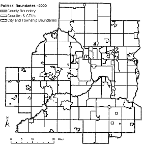
MSDI Data: Jurisdictional Boundaries
This committee is no longer active. This webpage provides a record of its activities.
The MSDI Data Plan for Government Boundaries pertains to the jurisdictional boundaries of Minnesota and the counties, cities, townships, school districts, watershed districts, and tribal governments within it. Boundaries for the state and its counties are well established and do not change, but boundaries for cities, townships, and school districts change routinely.
The plan was intended to document the methods by which government boundaries are recorded as digital data, managed, and maintained; recommend actions and investments needed to ensure maintenance of accurate and current boundary data; and recommend strategies to ensure that like-boundary data, produced by multiple entities, can be easily assembled to minimize duplication of effort and coordinate like processes.
The strategic plan for addressing this state data need was being developed by a boundaries data workgroup with assistance from the Strategic Plan Committee of the Governor's Council on Geographic Information.
DATA USES
Boundary data support a variety of government functions, locally and statewide, and serve as visual reference elements for most maps. The state relies upon boundaries for purposes that include state aid calculations and voter registration support. Accurate boundaries are important for all jurisdictions with taxing authority or are concerned about legal authorities, rights, responsibilities and liabilities.
DATA STATUS
Many organizations maintain versions of boundary data to meet their operational needs, although in most cases no official version has been designated or endorsed. As a result, few authoritative statewide boundary maps exist. Statuses for widely used boundary data are described below.
- Municipal Boundaries. The Department of Transportation maintains statewide boundary data to support its highway state aid program. The data are widely used, but generally need processing to serve other purposes. Scale is sometimes an issue as the statewide data are produced for medium-scale mapping. Counties also maintain municipal boundary data to support their taxation responsibilities. The results sometimes meet larger-scale needs, but the absence of standards makes aggregating these sources across county lines difficult. MetroGIS is assembling county data to create a regional solution to large-scale mapping needs within the Twin Cities Metropolitan area. Participating counties have agreed to minimum data standards and custodial responsibilities to support this regional dataset.
- School Districts. Working with the Department of Education, the Land Management Information Center is compiling a new statewide data set, updated through local school district reviews. The results are suitable for medium-scale mapping. Some counties also produce school district boundary data that are useful for larger scale mapping needs. However, the absence of standards hampers regional and statewide aggregation of these sources. Washington County prototyped a proposed standard for Twin Cities metropolitan counties in 2000.
- Watershed Districts and Watershed Management Organizations. These watershed management entities are organized under the auspices of the Minnesota Board of Water and Soils Resources, which maintains statewide data suitable for small-scale mapping. Some districts and counties also maintain watershed jurisdictional boundaries for larger-scale mapping needs. The absence of data standards hampers aggregation from these sources for regional and statewide applications. Washington County is coordinating a study to propose data content standards and custodial responsibilities for the Twin Cities metropolitan area.
PLAN STATUS
An MSDI data plan for Government Unit Boundaries was not completed.
COSTS AND FINANCING
Costs for producing and maintaining boundary data currently are borne by organizations that need the data for their own needs. Sharing costs for maintaining common data that support operational needs of many organizations is recognized as prudent and cost effective, but estimates of these costs have not been made. Most boundary data available statewide are designed for small-scale or medium-scale applications and have been maintained independently of local efforts. Ideally, leveraging these efforts to develop and maintain boundary data for the entire state will improve the quality of available data and reduce total costs for data production. A statewide survey is needed to help identify existing data development activities and opportunities for collaboration.
KEY ISSUES
- Data specifications that support common business needs, including formats and scales, need to be clarified and documented to facilitate aggregation of like-boundary data and alignment with other boundary data.
- Processes for developing and maintaining data, especially those that change frequently, need to be assessed and possibly reengineered to improve the product and reduce costs.
- In most cases, explicit responsibility needs to be defined and accepted by primary data stewards and area aggregators, supported through formal agreements, if necessary.
RESOURCES
- Minnesota Geographic Data Clearinghouse. The MN Geographic Data Clearinghouse web site identifies data sources for boundary data currently available.
- Municipal Boundary Adjustments program. The MBA program is responsible for the processes to adjust municipal boundaries within Minnesota.