MSDI Data: Geodetic Control
 This committee is no longer active. This webpage
provides a record of its activities.
This committee is no longer active. This webpage
provides a record of its activities.
Geodetic control serves as a common reference system for establishing coordinate positions for all geographic data. Traditionally, geodetic control points are established as permanent physical monuments placed in the ground and precisely marked, located, and documented. Specifying locations of features relative to geodetic control makes it possible to assess the locational accuracy of these features. Interest and activity regarding geodetic control has dramatically increased, corresponding to the need for accurate maps and surveys for geographic and land information systems.
The MSDI Plan for geodetic control envisions a state-local collaborative solution. The state assembles an electronic database about geodetic connected monuments and makes it readily available to all users over the Internet. The database features control survey monument data that are readily useable and meet the broad user community’s desired specifications for accuracy. Many organizations contribute information to the geodetic control network. A statewide solution for real time kinematic GPS surveying enables greater efficiencies to the data producing organizations. Funding and other incentives enable state agencies and local units of government to add to the control survey network and encourage participation and publication of their data.
The strategic plan for addressing the state's needs for geodetic control was being developed by a geodetic control data workgroup with assistance from the Strategic Plan Committee of the Governor's Council on Geographic Information.
DATA USES
The Geodetic Control network is a very high priority for professional surveyors, GIS developers and spatial data gatherers in Minnesota. Control surveys establish precise horizontal and vertical positions of geodetic monuments. These serve as the basis for originating or checking subordinate surveys for projects such as topographic and hydrographic mapping, property boundary delineation, route and construction planning, and design and layout. They are also essential as a reference framework for giving locations of data entered in Land Information Systems (LIS) and Geographic Information Systems (GIS).
DATA STATUS
- The primary source for geodetic data is the National Geodetic Survey (NGS), which maintains a nationwide geodetic control network. This network of stations, the National Spatial Reference System, is documented in a national database available through the Internet.
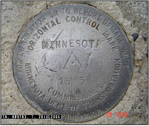
- The Minnesota Department of Transportation's (Mn/DOT) Geodetic Unit supplements the NGS survey stations with additional stations to establish control for Mn/DOT projects. The survey data for these stations is submitted to the NGS for final computation and publication. The Mn/DOT's Geodetic Unit also publishes its data through the Internet.
- Mn/DOT’s Geodetic Unit has completed the densification of the High Accuracy Reference Network (HARN) system to a 25-kilometer grid. The Geodetic Unit is working with Minnesota counties to place permanent physical monuments at three-mile intervals. These densification projects are helping to develop a statewide geodetic control network with centimeter accuracy. This accuracy provides better geodetic control for right-of-way acquisition, construction, maintenance, and GIS data collection.
- Global Positioning System (GPS) technology and the completion of the Continuously Operation Reference Stations (CORS) has given the Minnesota surveying and mapping communities the ability to develop georeferenced databases with a one-to-three-meter accuracy. Higher accuracies are still needed in many areas of surveying and mapping.
- Mn/DOT has completed testing a Virtual Reference System (VRS) in the Twin Cities. This wireless communication system allows GPS users with differential signal collection capabilities to gather real-time location information. A proposed statewide network of 125 permanent continuously operating GPS base stations, broadcasting and storing centimeter accuracy GPS signal correction messages, along with the positioning technology of the GPS, will provide the ability to obtain precise horizontal and vertical measurements in real-time.
PLAN STATUS
The MSDI Data Plan for geodetic control (version 1.1) was completed in May 2003 and reformatted in August 2003.
COSTS AND FINANCING
The current state geodetic control network is supported in Mn/DOT’s operating budget. Costs to complete densification, expand the GPS referencing system, facilitate data entry, and expand local participation have not been determined.
KEY ISSUES
- Formalize Mn/DOT’s role as data steward. An expanded statewide geodetic control network would be built by the state of Minnesota and made accessible to all users.
- Improve tools to allow counties and other land holding entities to add their data to the statewide geodetic control database.
- More local participation is needed to densify the geodetic control system.
- Funding and other incentives are needed to encourage state and local units of government to publish their data to the statewide control survey framework.
RESOURCES
- Geodetic Control Data I-Plan, Version 1.1 (May, 2003). Plan prepared by the MSDI Geodetic Control data workgroup.
- MnDOT's Geodetic Data Resources. The Office of Land Management in Minnesota's Department of Transportation maintains the state's geodetic control database and links to other resources related to geodetic control data.