Digital Soil Mapping in Minnesota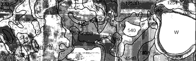
This site provides information about county-level and statewide digital data sets that describe the soils of Minnesota. Status information and links to detailed descriptions of the characteristics and limitations of the data sets are provided.
Detailed digital data
The data sets described in this section were created from the printed county soil surveys from the Natural Resources Conservation Service. The areas included in these different data sets cover most of the state; they are all free online.
- SSURGO: The Soil Survey Geographic data set (SSURGO) from NRCS is considered the best available digital soils data in Minnesota.
-
Web Soil Survey
View soil maps and reports on the web, or download the data. Web Soil Survey is the authoritative source for SSURGO data and reports. Since the data, especially the tabular portion, is evolving, it is important to make sure you have the most recent version from the site. NRCS includes a version number so that you can verify that you have the latest data. -
Soil Data Viewer
This free ArcGIS extension from NRCS streamlines the process of querying SSURGO data and producing reports and maps. Users who do not have ArcGIS but who have Microsoft Access can run a version that produces reports (no maps). NRCS provides installation instructions and a users guide, including help with obtaining and preparing SSURGO data for use with the extension. - NASIS database: SSURGO soil attributes are stored in Microsoft Access database tables; NASIS replaces the previous MUIR database.
-
National status map
-
Web Soil Survey
-
Gridded SSURGO (gSSURGO): A statewide raster dataset created by NRCS from vector SSURGO data. gSSURGO is in Esri file geodatabase format, 10-meter resolution.
General digital data
The three statewide data sets are less detailed than the county data sets; however, they are suitable for statewide or regional analysis.- U.S. General Soil Map (STATSGO2): The State Soil Geographic database, created by the Natural Resources Conservation Service, shows the boundaries of soil associations at a scale of 1:250,000. Soil associations are more general than the soil series mapped in NRCS's county soil surveys. The data, including additional information and help, are free online from NRCS.
- Minnesota Soil Atlas: This 1:250,000-scale data set shows soil landscape units created using combinations of four characteristics: sub-surface soil texture, surface soil texture, drainage, and surface color. It was created from the preliminary Minnesota Soil Atlas sheets developed by the Department of Soil Science, University of Minnesota, in cooperation with NRCS. It is available free online.
- Cummins and Grigal: This 1:1,000,000-scale data set contains polygons based on areas of common soil and landform characteristics, and is useful for regional analysis. See the map's companion document, Legend to Map: Soils and Land Surfaces of Minnesota 1980
(PDF, 3542K), J.F. Cummins and D.F. Grigal, Department of Soil, Water and Climate, University of Minnesota Agricultural Experiment Station. Formerly available on the DNR Data Deli, the data set has not yet migrated to the Minnesota Geospatial Commons.
Contact the Commons email if you have questions.
Published county soil surveys
The published county soil survey books from NRCS are divided into three parts: Part 1 provides a general description of a county's soils; Part 2 contains detailed soil descriptions and information on the use and management of the soils; Part 3 contains a general map of soil associations and many detailed maps of soil series overlaid on an air photo background. Note that NRCS is no longer publishing these books on paper; many books are available as PDF files that can be downloaded.
- Online copies: List of published surveys, publication dates, PDF format versions, and contact information for Minnesota NRCS.
- Online tables: For each Minnesota county, Section II of NRCS's electronic Field Office Technical Guide (eFOTG) provides access to tables of soil properties.
- National Soil Survey Handbook: Detailed explanation of NRCS's soil update procedures.
- History and uses of Minnesota soil surveys
Crop productivity index ratings
Crop Productivity Index ratings from the Natural Resources Conservation Service provide a way to compare the relative productivity of soils. For more information, click
here.Crop Productivity Index ratings supersede the older system of Crop Equivalent Ratings (CERs) computed by the University of Minnesota.
Background
In a 1994 survey of Minnesota GIS users, digital soils data was identified as the number one data need. There was a particular need for detailed data sets based on the printed county soil surveys created by the Natural Resources Conservation Service. To help focus a plan for obtaining these detailed data sets, the Minnesota Governor's Council on Geographic Information published County Soil Surveys: Guidelines for Digitizing (June, 1997). Each county's printed soil survey was placed into one of four categories based on whether the soil classification was modern or outdated and whether or not the survey had been produced using an orthophoto basemap. (See the map on page 7 of the report showing the category for each county.) For more information about the creation and uses of the printed surveys, see a brief history of soil mapping in Minnesota. The report recommended various digitization options and discussed intermediate digital products that could be used until higher quality data became available.
Contact and update information
This site represents MnGeo's most up-to-date understanding of the status of a variety of soils data for Minnesota. If you know of other publicly available soils information sources, please let us know: gisinfo.mngeo@state.mn.us