MSDI Data: Hydrography
This committee has been replaced by the Hydrography Committee of the Minnesota Geospatial Advisory Council. See their webpage for more recent information.
MSDI framework hydrography data includes surface water features – lakes, rivers, wetlands, and watersheds, structured to reference data related to those features. Referenced data include stream flow measured at gage locations; trout stream designations; point discharger locations; or water quality, water levels, or zoning as lake descriptors. Surface water features need the following characteristics:
- Good spatial representation
- Stable and consistent identification codes tied to established state and federal standards
- Vertical integration among river, lake, wetland, and watershed features if maintained as separate GIS layers
- For rivers, the ability to identify a location for a stream-related characteristic, feature or activity through an ‘addressing’ scheme
- For rivers, connectivity through lakes, wetlands, and two-dimensional river features
Changes in hydrology and data capture improvements necessitate periodic updates to these data. The hydrography data plan focused on “framework” data. Geology, hydrogeology, aquifers, wells, ground water extent or quality data will be addressed at a later time.
The Hydrography Committee of the Governor's Council on Geographic Information serves as the MSDI Cadastral data workgroup. Its members are responsible for developing and maintaining a strategic plan for meeting the state's needs for hydrography data.
DATA USES
- Maps of rivers, lakes, wetlands, and watersheds at various scales as reference layers
- Maps of water characteristics, such as impaired waters maps or trout stream maps
- Analysis of relationships among water-related features, such as discharges into rivers in relation to surface water intakes
- Analysis of upstream/downstream relationships among river features, characteristics, or activities, especially useful for assessing impacts of hazardous spills or discharges on downstream water users
- Engineering applications, such as hydraulic analysis for bridge and road construction and inputs to engineering models
DATA STATUS
Through coordination and significant collaborative investments by many agencies, Minnesota has developed several statewide hydrography datasets consistent with federal standards.
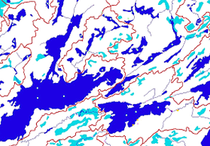
- DNR 24K Streams and Lakes. This statewide dataset represents basic lines for river and lake features. DNR derived rivers from the Mn/DOT base map data and lakes from the National Wetland Inventory. Development is completed.
- National Hydrography Dataset, High-Resolution. With production spearheaded by the MPCA, the High-Resolution National Hydrography Dataset (NHD) is 95 percent completed for the state. Using the DNR 1:24,000 streams and lakes as input and software provided by federal agencies, the NHD offers consistency with national standards.
- Wetlands. The National Wetlands Inventory for Minnesota was completed in the early 1990s. The data update issue is being studied by the Comprehensive Wetland Assessment, Monitoring and Mapping Strategy Project and the U.S. Fish and Wildlife Service.
- Watersheds. The last statewide watershed layer was completed by the DNR in 1999. The DNR has completed 30 percent of a project to improve delineation of watersheds and add delineations for all lakes greater than 100 acres. Additional work is needed to bring the DNR’s watershed data into full compliance with the federal Watershed Boundary Dataset .
- Hydrographic Events. The statewide 1:24,000 NHD layer provides the consistent, networked data that supports mapping of hydrographic events. An MPCA project to reference key data about rivers and lakes to the NHD will begin in fall 2004.
PLAN STATUS
A draft MSDI Data Plan for hydrography was prepared in March 2003 and revised in February 2004.
COSTS AND FINANCING
Data development has been dependent largely on short-term grants. There is no long-term funding plan for data completion and update for all hydrography layers.
KEY ISSUES
- Scale. Statewide databases are produced at a 1:24,000 scale. Larger scale sources are needed for some state and local government applications, engineering applications, and some legal designations. Some uses that cross state boundaries require smaller scales.
- Roles and responsibilities. With a few exceptions, roles and responsibilities have not been defined for updating key hydrography data layers or for maintaining vertical integrity among the various data sets.
- Long-term funding. Long-term funding sources for completing and maintaining these databases have not been identified or secured.
- Data standards. The Hydrography Committee has established standards for naming and feature identification of lakes, rivers, and watersheds, and will complete a hydrographic event standard next year.
RESOURCES
- Hydrography Data I-Plan, Version 1.1 (March, 2003). Plan prepared by the MSDI Hydrography data workgroup.
- Hydrography Committee resources. The website for the Hydrography Committee of the MN Governor's Council on Geographic Information contains other resources related to the MSDI.