MSDI Data: Imagery
This committee is no longer active. This webpage provides a record of its activities.
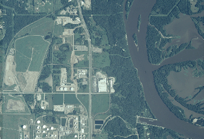
Imagery, especially digital photographs derived from planes or satellites and registered to real-world coordinates, is fundamental to the effective use of GIS. All aerial images are valuable, but images that have been adjusted by removing distortions resulting from terrain relief and camera or sensor orientation are especially valuable. These orthophotographs have the geometric characteristics of maps and the image quality of photographs. The MSDI plan for imagery concerns all forms of photographic sources, but primarily focuses upon orthoimagery.
Up-to-date orthoimagery can support many GIS-supported business functions within Minnesota, but orthoimages with complementary specifications are required to meet all needs. Scale, resolution, color, and time of year are especially important considerations for some applications. Orthoimagery also serves as a basis for developing other geospatial data, including data related to transportation, hydrography, critical infrastructure, and land use/land cover. New imagery must be acquired periodically, especially where development, construction, natural processes, and other factors change the physical landscape.
The strategic plan for addressing this state data need was being developed by an imagery data workgroup with assistance from the Strategic Plan Committee of the Governor's Council on Geographic Information.
DATA USES
Representative applications of orthoimagery and the specifications they require are:
- Engineering. These applications require the greatest detail and accuracy. Detailed imagery is especially useful along highway and infrastructure construction corridors. Typical specifications: 6-inch to 1-foot resolution, black and white images, leaf-off conditions.
- Local and strategic planning. These applications require moderate detail and resolution. Examples include emergency planning, crime analysis, site planning, and comprehensive plan preparation. Typical specifications: 1-foot to 1-meter resolution, black and white or color images, leaf-on or leaf-off conditions.
- Natural resource and land use interpretation and management. These uses generally require less detail and spatial accuracy. Examples include change detection, wetland management, lakeshore protection, and timber harvest management. Typical specifications: 1-meter to 30-meter resolution, natural color, color infrared, or multispectral images, leaf-on conditions.
- Broad-stroke or generalized characterization of landscape. These uses generally depend upon identifying the relative location of a feature at an economical cost. Use with detailed vector data is not common. Examples include natural hazard and pollution monitoring, mineral exploration, natural reserve management, and land cover mapping. Typical specifications: 1-meter to 30-meter natural color, leaf-on conditions.
DATA STATUS
Statewide orthophotography for Minnesota has been acquired only twice, during the 1989-1992 period and in 2003. The first-generation products, contracted through the U.S. Geological Survey and costing about $5 million, were black and white images and flown under leaf-off conditions, which is especially useful for revealing infrastructure. The 2003 images, contracted through the U.S. Department of Agriculture Farm Services Agency, were produced in color, which is especially useful for agricultural and natural resources applications. The total cost for the second-generation images was under $1 million. All data are available through the Minnesota Geographic Data Clearinghouse as well as other sources.
Higher resolution imagery is produced on a periodic basis for specific purposes, especially by local units of government. For example, Minneapolis has an active program to acquire 6-inch resolution color imagery for the Minneapolis area every 3 years. The Metropolitan Council acquires 2-foot imagery on a three to five year cycle. Some sharing of available imagery occurs through word of mouth and organizations such as MetroGIS, LMIC and DNR. Limited coordination of planned imagery projects occurs primarily through informal communication networks.
PLAN STATUS
A draft MSDI data plan for imagery was prepared in May 2003 and updated in September 2003.
COSTS AND FINANCING
Costs for imagery acquisition vary, depending on product criteria. Recently acquired six-inch resolution color orthoimagery for urbanized areas such as Scott County and the City of Minneapolis cost $700 to $1,000/square mile. Recently produced one-meter color imagery for the entire state cost about $11/square mile. Satellite imagery is becoming competitive for some applications and is available from commercial sources costs at about $11/square mile for 2.5-meter black and white images. Some agencies that use imagery depend upon a periodic budget for image acquisition.
KEY ISSUES
- To remain up-to-date and useful, orthoimagery must be periodically replaced.
- Statewide orthophotography meets many needs, but future success depends upon strong coordination among state agencies and other units of government and their ability to contribute towards total project costs.
- A mechanism is needed to publicize available imagery and planned imagery projects to facilitate cost sharing and expand data availability.
- Conflicting specifications for orthoimagery limit their shared use. Standardizing a “menu” of specifications for resolution, spatial accuracy, color, flight height, and time of year can create opportunities for cost sharing.
RESOURCES
- Imagery Data I-Plan. Latest working draft of strategic plan for imagery data.
-
"First Stop" site for imagery data. This page at the MN Geographic Data Clearinghouse website contains an comprehensive overview of imagery data resources available for Minnesota.