MSDI Data: Soils
 This committee is no longer active. This webpage
provides a record of its activities.
This committee is no longer active. This webpage
provides a record of its activities.
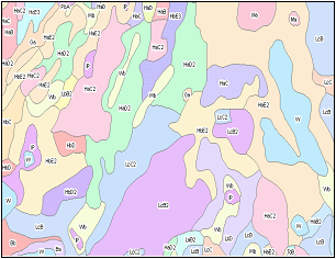
Minnesota soils have been mapped at scales and complexities ranging from page-size state maps with general soil features to detailed site plots. Minnesota is part of the National Cooperative Soil Survey, which creates detailed soil maps at the county level. The county soil survey program was established in 1899 within the U.S. Department of Agriculture to help farmers determine the crops and management practices most suitable for the soils on their farm. As scientists learned more about soils, they investigated soil characteristics for other land uses. Modern soil surveys can be used for such diverse activities as highway construction, farm planning, tax assessment, forest management and ecological research. Soils GIS data sets include delineations identifying soils with similar characteristics and tables describing various attributes of each delineated soil type.
The strategic plan for addressing this state data need was being developed by a soils data workgroup with assistance from the Strategic Plan Committee of the Governor's Council on Geographic Information.
DATA USES
- Site-level management and engineering. Detailed applications such as precision agriculture or the siting of septic tanks require on-site investigation by a professional soil scientist to augment the county soil survey (if available). Scale: up to 1:5,000
- Local planning. In addition to agricultural uses, county soil surveys usually provide sufficient detail to support comprehensive planning for residential and commercial development, transportation, recreation, open space and natural areas. Scale: 1:20,000
- Generalized characterization of the landscape. Statewide data sets, with generalized resolution or attributes, often provide sufficient information to support broader management and ecological research projects. Scale: 1:250,000 – 1:1,000,000.
DATA STATUS
County-level data. The National Cooperative Soil Survey (NCSS) provides the source material for Minnesota’s county digital soils data. To meet today’s uses, the surveys must have attributes based on a modern classification and be referenced to an orthophoto base. Surveys for 49 Minnesota counties meet this standard, 35 do not, and three have no survey at all. The Natural Resources Conservation Service (NRCS) and the University of Minnesota (U of M) are working to upgrade many of the outdated surveys to produce the Soils Survey Geographic dataset, known as SSURGO, the highest quality digital soils data available. Half of Minnesota’s counties are completed; 29 more are planned or in progress. Soils data produced by the University of Minnesota for the Soil Survey Information System (SSIS) and by the Metropolitan Council for the Twin Cities metropolitan area will be superseded as SSURGO is completed. SSIS is available for 18 counties outside the Twin Cities; the metropolitan area data cover five Twin Cities counties. SSURGO is a medium-scale dataset at 1:20,000 or 1:15,840.
Statewide data. Several sources of digital data are complete for the entire state, although they are best suited for very small-scale applications and not for applications such as precision agriculture, for example.
- STATSGO. Produced by the Natural Resources Conservation Service, STATSGO shows a more generalized soil association level that used for the county surveys. Scale: 1:250,000.
- Minnesota Soil Atlas. Produced by the University of Minnesota, the Atlas characterizes soils by combining soil landscape units and geomorphic regions. Scale: 1:250,000.
- Soils and Land Surfaces of Minnesota – Cummins & Grigal. This University of Minnesota data classifies soils using major factors influencing soil formation. Scale: 1:1,000,000.
PLAN STATUS
An MSDI Data Plan for soils was not completed.
COSTS AND FINANCING
The Natural Resources Conservation Service (NRCS) has contributed the major share of funding to create Minnesota’s county-level soils data; augmented by several million dollars from the state. In most cases, counties have had to contribute cost-share funds. For FY05, the Legislative Commission on Minnesota Resources (LCMR) is recommending that Minnesota contribute $300,000 to update Crow Wing County’s soil survey and to create a survey for Pine County. LCMR is also recommending $200,000 for the Board of Water and Soils Resources for continuation of the Internet Delivery of Digital Soils Data project.
KEY ISSUES
- Update county soil surveys and create additional SSURGO data sets to reach the goal of statewide coverage.
- Soils data is complex to use because of its data structure. To address this issue, the NRCS has created Soil Data Viewer software. This software needs to be expanded to support more GIS software options.
- Make data more understandable and accessible to the non-GIS user and to people who are not soils experts.
RESOURCES
- "First Stop" site for soils data. This page at the MN Geographic Data Clearinghouse web site contains an comprehensive overview of soils data resources available for Minnesota.