Land Ownership Information for Minnesota
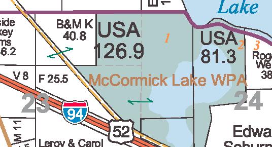 |
Portion of the Stearns County plat book (Courtesy of Stearns County Auditor / Division of Land Management. Copyright Stearns County.) |
Who owns land in Minnesota? How much is publicly owned and how much is private? This overview site provides links to information available to help answer such questions, ranging from parcel boundary maps to statewide inventories of public land to fascinating histories of how land ownership patterns developed over time.
Parcel boundaries
Parcel boundary data, maps and ownership records are maintained at the county level, usually by the recorder's, assessor's or land surveyor's offices. Many Minnesota counties keep records in digital format and provide parcel information websites for use by the general public. The boundaries shown on the maps and the GIS data sets are approximate -- they are not substitutes for certified property surveys, legal property descriptions or detailed plat maps. Property records may also be referred to as parcel, cadastral, real estate or real property records.
- Data sources: Online parcel maps, plat books, downloadable data, and county contacts
- Land records modernization efforts
- Property surveys and legal descriptions of land: Information from the Minnesota Society of Professional Surveyors
-
Parcel Data Transfer Standard for Minnesota
Statewide inventories of public land
Several inventories have assessed overall patterns of public land ownership in Minnesota. These inventories are snapshots in time, primarily from the mid-1980s and earlier, and are intended for overview and general planning purposes.
More information on general inventories
Historic and educational resources
Online and printed maps, atlases and reports reveal historic land ownership patterns and describe underlying forces influencing the ownership landscape we see today. View or download digital copies of historic Minnesota township plat maps collected during the original Public Land Survey.
More information on historic and educational resources
State land for sale
Occasionally, state land is sold. Check the following websites:
- Department of Natural Resources, Land and Minerals Division: Frequently-asked questions about land sales and acquisitions
- Department of Transportation: Property and buildings for sale
- Department of Administration, Real Estate Services: Real estate for sale
Related land sale and property search sites:
-
Site location tools of available commercial land, sites and buildings throughout
Minnesota from the Department of Employment and Economic Development
Contact and update information
The information above represents MnGeo's most up-to-date understanding of land ownership data for Minnesota. If you know of other publicly available land ownership information sources, please let us know: gisinfo.mngeo@state.mn.usBack to top