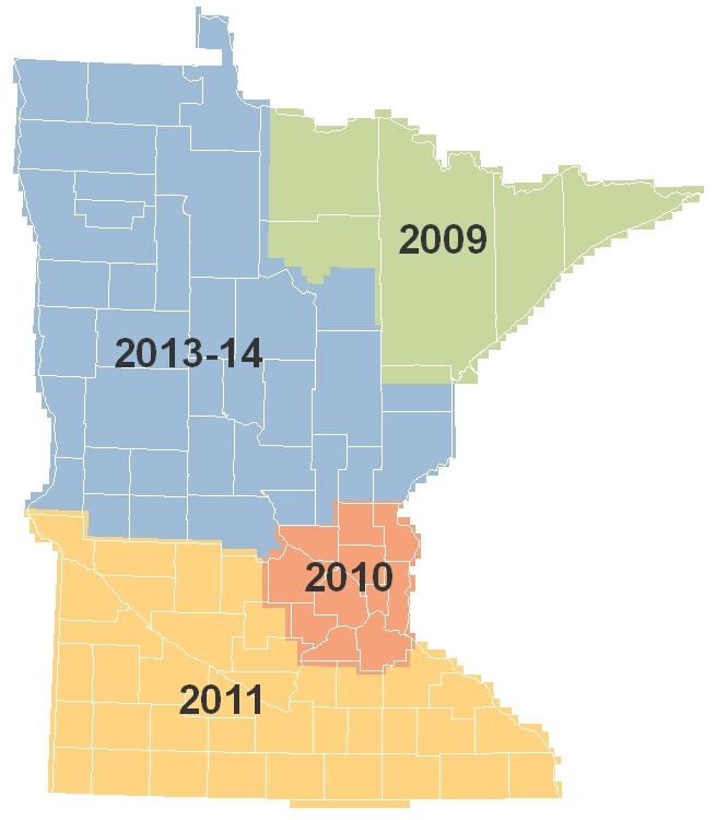
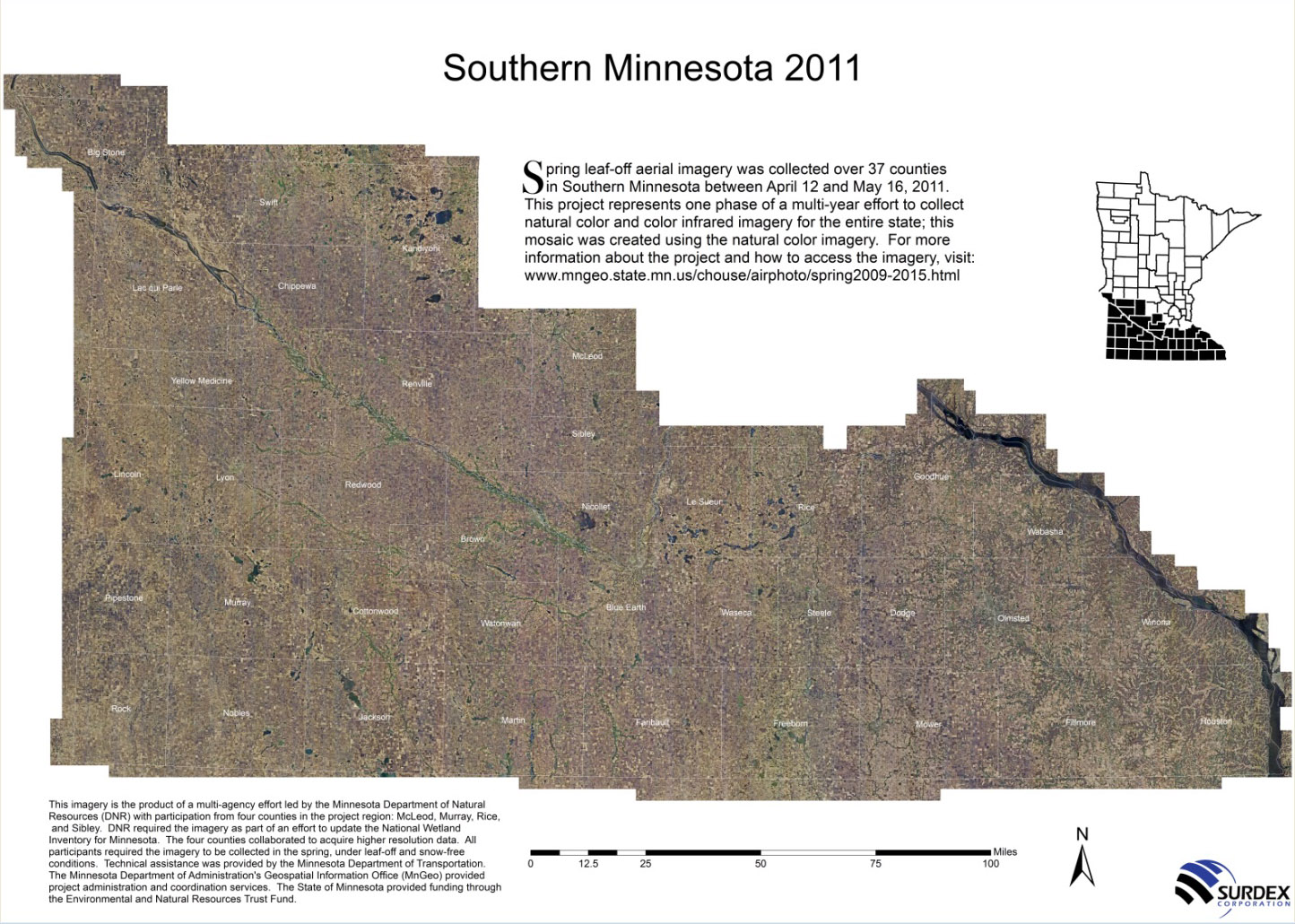
Spring Aerial Imagery of South Minnesota: Spring 2011
Spring Imagery Home |
Northeast |
East-Central |
South |
Central and Northwest
 High-resolution orthophotography
was collected by
Surdex Corporation for 37 southern Minnesota
counties in Spring 2011. Meeker County could not be collected due
to advanced leaf-out, so was flown Spring 2013 and is available.
High-resolution orthophotography
was collected by
Surdex Corporation for 37 southern Minnesota
counties in Spring 2011. Meeker County could not be collected due
to advanced leaf-out, so was flown Spring 2013 and is available.
- Project brochure (2 p., 570K, PDF)
- Mosaic image poster
- Documentation:
0.5-meter resolution
and horizontal
accuracy report
View Imagery
The imagery is
available via MnGeo's WMS image service
Details
- Resolution:
- Half-meter resolution imagery was acquired for 37 counties: Dodge, Faribault, Fillmore, Freeborn, Goodhue, Houston, Jackson, Kandiyohi, Lac qui Parle, Le Sueur, Lincoln, Lyon, Martin, McLeod, Mower, Murray, Nicollet, Nobles, Olmsted, Pipestone, Redwood, Renville, Rice, Rock, Sibley, Steele, Swift, Wabasha, Waseca, Watonwan, Winona and Yellow Medicine. Meeker County could not be collected due to advanced leaf-out, so was acquired Spring 2013.
- All of the one-foot resolution imagery was acquired for the 3 counties participating in the resolution buy-up option: McLeod, Murray and Sibley.
- All areas postponed from 2010 were acquired: Goodhue and Rice counties; downtown St. Paul (reflown to minimize building lean); and stereo imagery at 0.5-meter resolution for Dakota, Goodhue, Rice and Scott counties.
- Thanks are due to a network of volunteer observers who reported on field conditions to help with flight planning.
- More
details in
- May 2012 project report
- January 2012 project report
- September 2011 project report
-
RFP (12/6/10, Vol. 35, No. 23, p. 870);
Surdex
Corporation was selected as the vendor
Regional Information Meetings
Three regional meetings were held in 2010 to gauge interest in local partnerships, one on June 22 in Marshall, and two on July 1 in Rochester and Mankato.
- Presentation slides
from regional information meetings (25 slides, 7.6 MB, PPT)
Project Contacts
| MnGeo gisinfo.mngeo@state.mn.us |
Steve Kloiber, Project Coordinator National Wetlands Inventory Update Minnesota Department of Natural Resources 651-259-5164 steve.kloiber@state.mn.us |
Return to MnGeo's first-stop Aerial Photography page